Why Side Streets Often Meet at Unexpected Angles
Why side streets meet at unexpected angles: read old routes, property lines and later connections to understand the history beneath a city junction.
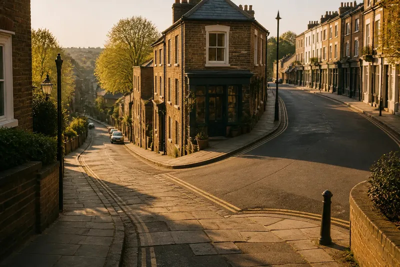
The common mistake is to assume a side street must have been laid out to meet its neighbour neatly; that assumption can make an ordinary junction seem like a planning blunder. Why side streets meet at unexpected angles is often a story of routes and boundaries laid down at different times, with the awkward turn left visible in the pavement.
Spend a week noticing one angled junction on your regular walk. You do not need a map archive or a theory about the whole neighbourhood: look at the approaches, compare the street edges and ask what each route seems to connect. The aim is to read the junction as a meeting point between layers, not as a single design decision.
Choose a useful junction
Pick a place where two streets meet obliquely, or where one seems to run into the side of another rather than continuing straight across. A junction near a shop, bus stop or familiar landmark is easier to revisit, but avoid choosing one so busy that you cannot pause safely. Observe from the pavement, clear of driveways and crossings.
On your first pass, note only what is plainly visible. Which street appears to continue through? Does the narrower one arrive at a sharp corner, a broad triangular pavement or a small wedge of buildings? Are the kerbs aligned, or does one edge kink just before the meeting? These details give you something specific to check later.
Keep a small notebook or use a simple sketch on paper. Draw the street edges as lines, mark the junction and add an arrow for each direction of travel. Do not try to make the drawing accurate to scale; it is a record of relationships, not a survey.
Read the older route
During the next few days, look for signs that one street may follow an older path. A route that bends gradually can preserve the shape of a lane or track, while newer streets may run in straighter lines between planned blocks. A sudden change in paving, a narrow passage continuing behind a row of buildings, or a street that points towards a bridge, market or former settlement edge can offer clues.
None of these clues proves a route’s age on its own. A winding street can be recent, and a straight one can follow a long-established boundary. Treat them as questions to investigate: does the street’s direction make sense if it once linked two destinations that are no longer obvious from the junction?
If you have access to a public map, compare a current street map with an older local map held by a library or archive. Look for the same bend, lane or connection appearing before the surrounding blocks took their present form. If no useful map is available, keep the claim tentative and rely on what the layout itself supports.
Trace property edges
Next, examine the buildings and open spaces along each approach. Property boundaries can outlast the use that created them. A line of rear gardens, a long boundary wall or a run of narrow plots may resist a later street grid, leaving a diagonal edge where newer streets meet older parcels.
Notice whether the angle appears only at the road surface or also in the shape of nearby lots. If a row of buildings follows the same slant, the street may have been fitted around an established property line. If the buildings are square to one street but the pavement cuts across their frontage, a later road connection may have altered the route without completely reorganising the plots.
Do not infer ownership or land history from appearance alone. Your useful observation is simpler: identify which edges repeat the angle, then see whether a map or public local-history resource offers a plausible explanation.
Watch later connections
On another walk, follow each street away from the junction rather than judging it from the corner. A short side street may have been added to connect an older route with a newer main road. If it meets at an angle, the connection could have been made where access was possible, rather than where a clean geometric intersection would have fallen.
Look for a change in street width, building scale or alignment just beyond the junction. A broad road may continue on a planned line while the side street turns towards it; a row of older buildings may hold its course as newer construction gathers around it. Such contrasts can suggest that the connection came later, but they are not a date stamp.
Say you notice a narrow lane approaching a broad avenue at a slant, with a wedge-shaped corner building and older-looking plots continuing along the lane. You sketch both edges, then compare the junction with an older map from the local library. If the lane appears before the avenue, you can reasonably describe the angle as a later connection meeting an older route; if the map is inconclusive, note the visible evidence without declaring a definitive origin.
What should you look for?
Does an angled junction prove the streets are different ages?
No. Different construction periods are one possible explanation, but terrain, property lines and later alterations can also shape an angle. Look for supporting clues along the streets and in the surrounding plots.
Can a property boundary shape a street?
It can influence where a route fits, especially where established plots or walls constrain later building. A matching diagonal in nearby parcels is a clue to examine, not proof of a particular ownership history.
Which map should you compare?
Start with a current street map and, if available, an older map from a library, archive or local-history collection. Compare the same junction and nearby street edges rather than relying on a broad neighbourhood view.
What if the evidence does not agree?
Keep the explanation open. Record what you can see, separate observation from inference and leave uncertain details unresolved rather than forcing one tidy story onto the junction.
Make a clear field note
At the end of the week, return to your sketch and write three short notes: what the junction looks like, which features repeat its angle, and what a map comparison suggests. Use wording such as “may follow” or “appears to connect” where the evidence is incomplete. This keeps your account useful without turning a plausible reading into a claim of fact.
There is little value in measuring every kerb, estimating construction dates from brick colour or trying to assign an exact age to each building by sight. Those details can distract from the stronger pattern: which route bends, which edge persists and where the connection seems to have been added. For a routine way to read why side streets meet at unexpected angles, revisit the same junction as you move through the week; the changing view often reveals more than a single glance from the corner.